Fire Frequency Map
on January 11, 2019
with No Comments
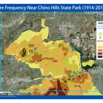
This map shows the Fire Frequency in and around Chino Hills State Park between 1914-2018. Download the Fire Frequency Map as a PDF.
This map shows the Fire Frequency in and around Chino Hills State Park between 1914-2018. Download the Fire Frequency Map as a PDF.
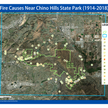
HFE documented 106 separate fire points of origin in its updated study. The majority of fire causes are unknown, but of the known causes: arson, automobiles, and fireworks take the lead. Icons delineate the fire’s cause, use the maps legend for clarification. Download the Fire Causes Map as a PDF.
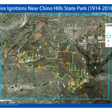
Through its Fire Study, Hills For Everyone documented 106 separate fire points of origin in its 2019 study. Flames in color have a known cause, while flames in grey have an unknown cause. Download the Fire Ignitions Map as a PDF.
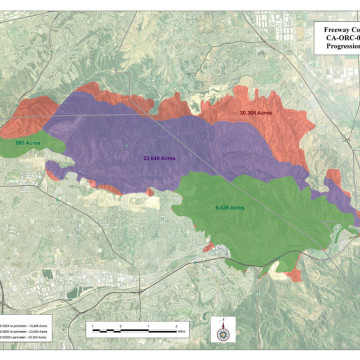
On November 15, 2008 two fires started on opposite ends of the hills about two hours apart. The first fire ignited near the 91 Freeway on the eastern side of the hills in Corona by an automobile exhaust catching dry brush on fire, while the second fire began nearly 11 miles away to the northwest, in Brea, due to an unmaintained power line that also ignited dry brush. Download the Freeway Complex Fire Map as a PDF.
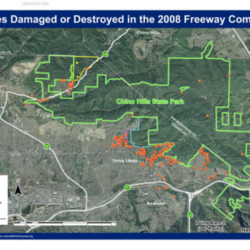
This map shows the properties damaged or destroyed by the Freeway Complex Fire and their locations relevant to Chino Hills State Park. Download the Freeway Complex Fire – Properties Map as a PDF.