New Redistricting Maps

New Redistricting Maps

with No Comments

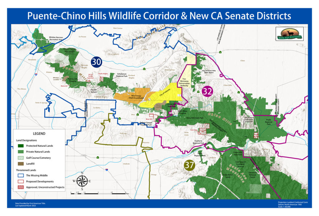
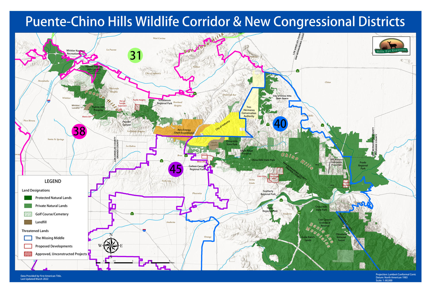
A lot of changes are happening with representation due to the information gathered from the US Census in 2020. This means state and congressional districts were redrawn and adopted in 2022 to better align with the demographics. Hills For Everyone took the final maps for the California Assembly and Senate, as well as the Congressional Districts and overlaid them with the Puente-Chino Hills Wildlife Corridor. See how things have lined up on the three maps below.

A map that states: "Puente-Chino Hills Wildlife Corridor and New Congressional Districts" with a map of protected and threatened landscapes in the Wildlife Corridor overlaid with four Congressional district boundaries (31, 38, 40, and 45).
The new Congressional Districts overlaid on the Puente-Chino Hills Wildlife Corridor map.
A map that states: "Puente-Chino Hills Wildlife Corridor and New CA Assembly Districts" with a map of protected and threatened landscapes in the Wildlife Corridor overlaid with three Assembly district boundaries (56, 59, and 63).

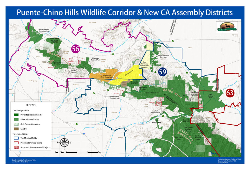
The new State Assembly Districts overlaid on the Puente-Chino Hills Wildlife Corridor map.

A map that states: "Puente-Chino Hills Wildlife Corridor and New CA Senate Districts" with a map of protected and threatened landscapes in the Wildlife Corridor overlaid with three Assembly district boundaries (30, 32 and 37)
The new State Senate Districts overlaid on the Puente-Chino Hills Wildlife Corridor map.