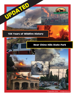
Given the recent upsurge in large damaging wildfires in California, six years after completing its first Wildfire History Report for Chino Hills State Park, Hills For Everyone updated its research to include fires between 2012 and 2018. The Study now includes 105 years of wildfire history. Though fires are a natural part of the ecosystem, there is nothing natural about the size and frequency of the fires destroying our wildlands year after year. Data, mainly from fire agencies, the California Department of Parks and Recreation, and newspapers, provided details on fire perimeters, points of origin, and fire causes. This paper updates tables, statistics, and maps, and reviews the recommendations from the 2012 Study to determine if progress has been made at reducing fire ignitions. A few additional recommendations and future areas to study are included in this report as well. We will continue to work with fire and natural resource agencies to bring the necessary resources to this area.
QUICK FACTS
- This study includes 90 fire perimeters and 106 points of origin totaling 151 separate fires that occurred between 1914 and 2018.
- Most of the new fires were small in size, extinguished quickly, and occurred on “normal” temperature, humidity, and wind days.
- The three most prevalent fire months are: July (33 fires), September and October (19 fires each).
- Five types of fire causes were added: road flare, cigarette, illegal campfire, prescribed burn, and accidental.
- The same “hotspots” where fires tend to occur still exist: the 91 Freeway, Rimcrest in Yorba Linda, and Carbon Canyon in Brea. A hotspot may be forming at the 57 Freeway with 11 fires in three years.
THE REPORT
Hills For Everyone (HFE) secured additional shapefiles (digital data sets) or coordinates of fire perimeters and points of origin from the California Department of Forestry and Fire Protection (CalFire), the Orange County Fire Authority (OCFA), and Brea Fire Department. These fires were added into the datasets created in the 2012 Fire Study. HFE used the ArcMap 10.1, a geographic information system (GIS) program, to assimilate the fire data. To make the files publishable to the public we exported the ArcMap datasets into Google Earth.

THE DATASET
There are seven “layers” available for viewing in the Fire History of Chino Hills State Park (1914 – 2018) dataset.
- Chino Hills State Park
- Fire Perimeters
- Fire Causes and Points of Origin
- Fire Frequency
- Highways
- County Boundaries
- Study Area Boundary
DOWNLOAD GOOGLE EARTH
Step 1
- If you already have Google Earth installed, skip to Step 2.
- If you do not have Google Earth, download a free copy of the program from Google.
- Follow the installation instructions.
- Start the program.
Step 2
- Click on the KMZ file to open the Hills For Everyone dataset. It will automatically open in Google Earth, zoom into the Study Area and show the shape of Chino Hills State Park, the highways, county boundaries, and study area. You may need to zoom in or out to see the full dataset.

USING THE DATASET
We’ve created step-by-step instructions to help those of you who are new to Google Earth. Instructions include how to expand/collapse layers, turn on/off layers.
- Download Google Earth: The Basics file. (PDF – 688 KB)
Additionally, we’ve also created instructions to help you use the Hills For Everyone dataset. These instructions cover how to view the different layers, get details on a fire, find a matching point of origin, and more.
* NOTE: To provide a cleaner and easier view of the data, some of the instructions list details (source of the fire information, etc.) in the layers that weren’t included in this revision of the dataset. The remainder of the instructions remain the same.