Below is a list of the most important maps related to the Puente-Chino Hills Wildlife Corridor. Visitors can view the electronic map or download it as a PDF.
Puente-Chino Hills Wildlife Corridor Map
on January 16, 2019
with No Comments
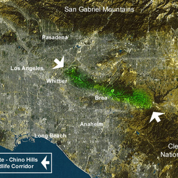
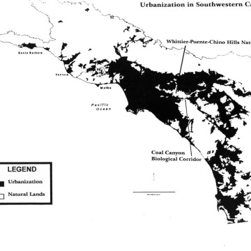
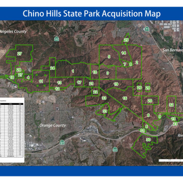
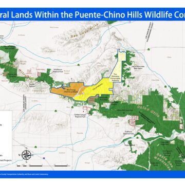
Hills For Everyone updates regularly its base map for the Puente-Chino Hills Wildlife Corridor. This map outlines the status of lands in the 31 mile long Wildlife Corridor, including existing publicly and privately protected natural lands, properties privately owned, threatened and proposed developments. Download the Puente-Chino Hills Wildlife Corridor Map as a PDF.